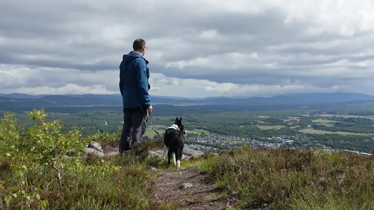
Aviemore has a variety of great walks nearby, offering family-friendly and circular hiking trails in some of the country’s most impressive scenery.
Located on the northern side of the massive Cairngorms National Park, Aviemore is a year-round hiking destination. Below is a summary of my 10 favourite low-level (ie: not mountain) hikes near Aviemore. Some are within the village, others are only a few miles away, but they all represent some of the most picturesque hiking in Scotland.
Go to:
Favourite walks near Aviemore
Below is my pick of some of the most well-known and worthwhile walks in the Aviemore area. Good signposting and regular path maintenance makes these paths accessible at any time of year. If you are looking forward to a spot of birdwatching in the Cairngorms, or simply taking in the views, you will certainly enjoy these routes. Plus, many of them are fine with a buggy or balance bike if you have wee ones.
Circular Aviemore walks
Circular routes can provide more of a sense of journey, with new views around every corner! Tip: to help get timings right, try and work out where is the halfway point.
Key to routes:
- Aviemore Orbital
- Loch an Eilein loop
- Whitewell loop
- Loch Morlich loop
- Rothiemurchus Beaver Trail
- Burma Road, short
- Craigellachie NNR
- Speyside Way (see map)
- Old Logging Way
- Green Lochain and Ryvoan bothy
Aviemore Orbital
The Aviemore Orbital path runs (as you would expect) around the outside of the village. On the western side, it follows the edge of the wooded slopes of Carn Mor (known locally as ‘High Burnside’). Its eastern leg takes you along the quiet waters of the famous River Spey, with great views of the Caingorm mountains. A mellow, circular family-friendly walk with minimal ascent and pleasant views around Aviemore – what’s not to like?
8 km / 5 miles
Note: it is pretty narrow and overgrown along the river in places!

Loch an Eilein
Loch an Eilein has one of the most famous circular walks in Scotland, loved by locals and visitors alike. A fine, gentle path runs around the perimeter of the beautiful loch, all located in the centuries-old Rothiemurchus estate. This gorgeous circular walk is ideal for families based in Aviemore because it’s close, has loos and a gift shop and is entirely doable with bikes or buggies. You will see some of the best old Scots pine forest in the region, a famous wee ruined fort on an island and perhaps red squirrels. Although it can be busy during holiday periods and there’s no free parking, it is definitely worth it.
5.5 km / 3.4 miles, start Loch an Eilein carpark (about 4 miles from Aviemore)

Whitewells
From the high point at Whitewells, you can get great views of Rothiemurchus and out to the hulking mountain Braeriach. This fine location provides an excellent start to many remote Cairngorms routes (although there’s only a few parking spaces). The Ordnance Survey maps show some ancient (but obscured) hut circles here and there can be good wildflowers in the summer. You can do a longer circular walk to here from Aviemore, along part of the Old Logging Way. However, the short option is to park at the Coylumbridge Hotel (use the overflow, not resident parking).
Distance: 5km / 3 miles, short option, start Coylumbridge Hotel (about 3km / 2miles from Aviemore)
Loch Morlich
Loch Morlich is one of the most well-known and popular beauty spots in the Cairngorms. Originally formed thousands of years ago by a crumbling glacier, the loch is now encircled by native Scots pine woods. As well as great views of the northern corries of Cairngorm and Braeriach, there are several routes of varying lengths, the highest beach in Britain and some friendly wee cafes. You can find plenty of paid parking in Glenmore (download the RingGo app). On the other hand, you can walk the whole distance from Aviemore using the Old Logging Way (see below). The wide, gentle walking trail is perfect for bikes, buggies or young families and it is only a short drive from Aviemore.
5km/3 miles, start Rothiemurchus Lodge vehicle bridge (9.5km / 6 miles from Aviemore).

Rothiemurchus Beaver trail
This is a relatively new addition to the walks in the area, although it does use the existing path network. Rothiemurchus’ ‘Beaver Trail’ provides a nice short loop via one of the Cairngorms beaver reintroduction sites. Well-designed interpretation is dotted along the trail, giving you insights into the biology of these fascinating big rodents. The trail passes very close to bodies of water where local beavers are present, although, at time of writing, these largely nocturnal newcomers are keeping a low profile! This is a nice wee walk that can be started directly from Aviemore, with the info points along the way maintaining interest for young family members.
7 km / 4 miles, start at Inverdruie triangle (about 2km / 1 mile from Aviemore centre)

Steep hiking trails
Aviemore also has a few steeper hiking trails, if you want to gain height and enjoy bigger views.
The Burma Road
Tremendous views await at the top of the Burma road – easily one of the steepest Aviemore hiking trails. In fact, this is the only walk on this list that strays into proper hillwalking territory. Topping out at 690m, the weather can be colder and windier than the valley, with a sustained steep walk up to the saddle. You might choose to bag the nearby 824m Geal-charn Mor, before following a less defined trail down to Ballinluig farm. A few parking spots are available at the bottom of the hill track, but don’t block access for estate vehicles. A 40km loop via the village of Carrbridge is popular with mountain and gravel bikers, but hikers could cut that in half by getting the bus to or from Carrbridge (see The Burma Road Aviemore: a wild, steep XC ride).
9.5 km / 5.9 miles, 523m/1716ft ascent. Start near Lynwilg (about 3.5 km / 2 miles from Aviemore centre)

Craigellachie NNR
Right at the southern end of Aviemore is a fantastic wee hiking trail through the secluded national nature reserve of Craigellachie. Take a wander through peaceful birch woodland on an all-abilities path and detour onto a narrower trail as it climbs up past a couple of clean lochains onto the hill above. The views are superb as you break out above the treeline into nicely varied heather moorland (there’s no grouse shooting here), eventually bringing you to the summit of Craigellachie (493m/1617ft). Drink in the wonderful views across the the valley towards the Cairngorms before following the well-made trail back down. It’s not terribly steep anywhere, but it is sustained, rocky and narrow in places.
6 km/3.7 miles, 296m / 971 ft ascent

Longer routes nearby
There are a number of longer linear routes in the northern Cairngorms which connect with many smaller village and woodland trails.
Speyside Way
The Speyside Way is one of Scotland’s main long distance trails. It runs all the way from near the headwaters of the famous river Spey, to its mouth on the Moray coast (around 165km including variations). The Aviemore to Boat of Garten section provides a gentle, wide, flowy walk via farmland, old villages, peaceful riverbanks and dense pine forest. The trail is plenty wide enough to cope with passing hikers, bikers and horseriders, but it rarely feels very busy. In addition, there’s lots of nice coffee and cake stops along this section! You could do it one-way via car / bus / taxi or the Strathspey Steam Railway. Alternatively, you can make a loop by connecting it with the many local forest trails.
9.8 km / 6 miles (Aviemore to Boat of Garten)
Old Logging Way
The Logging Way is a more recent hiking route which follows the pre-existing trail from Aviemore to Glenmore. Forestry has been a key industry in this area for centuries, and this route follows the track taken by generations of foresters as they extracted timber from Glenmore and Rothiemurchus. Over 3 centuries, foresters used various means for transporting timber, including horses, the river, roads and steam trains. Today, however, the relatively straight, wide trail provides a hiking option that is much safer than plodding along the edge of the road. Head up along the edge of the pine forest and you will eventually get great views over Loch Morlich towards Cairn Gorm itself. For the return to Aviemore retrace your steps, use other woodland paths or get a bus/taxi.
9.5km / 6 miles Aviemore to Glenmore

The Green Lochain and Ryvoan Bothy
So, is it faeries washing their clothes, or unusual staining by minerals? Whichever explanation you prefer, the Green Lochain is certainly a famous local landmark. It lies nestled within the gorgeous wooded Ryvoan Pass and is accessed via an ancient track that connects Glenmore with the parish of Abernethy. Rare and protected wildlife exists in these woodlands, so visitors are asked to stay on the trail and exercise responsible access. This trail works for buggies but it can be busy. Pick your moment and you can be treated to a wonderful oasis of peace and quiet deep within regenerating Scots pine forest. Continue uphill another kilometer or so to find the wonderful Ryvoan bothy and return the same way.
8.6 km / 5.3 miles there-and-back Glenmore to Ryvoan Bothy via the Green Lochain. Start at Glenmore (about 11km / 7 miles from Aviemore).
Tips for visitors walking near Aviemore
First off, always make sure you are adequately prepared for your hiking trip. Midges are rarely much of a problem but ticks can be (for advice, check out my post on preventing tick bites). Popular navigation apps like Outdooractive, OSMaps, Memory Map and Anquet will give you proper Ordnance Survey maps for routefinding (but note that signal can be limited in Glenmore). Aviemore-based taxis can provide a quick lift to or from many of these routes. If you prefer a bus, check out Stagecoach service 30, AKA the ‘Aviemore Adventurer‘. Responsible non-motorised access is permitted in Scotland, so be prepared to share trails with cyclists, horseriders and mobility scooters. For more local visitor info see my Cairngorms Guide.
Responsible access tips for hikers
- Take litter to a bin
- Use dog waste bins and public lavatories
- Stay on the trail
- Cook with a small camping gas stove
- Don’t damage trees or uproot wildflowers or fungi
- Minimise noise
- Follow landowners instructions
- Dogs on a lead or close at heel
- Make room for other trail users
- Wild camp away from the trail
Aviemore has plenty of great walking and hiking trails, including family-friendly circular, steep and long-distance routes. Paths are all well maintained and signposted and you are sure to see some great scenery and perhaps wildlife on the way. The trails are popular with both local and visiting hikers all year round, so you are sure to meet some interesting people. But you can also quickly escape into the secluded mountains and pineforests too!

Discover Cairngorms high points and more
